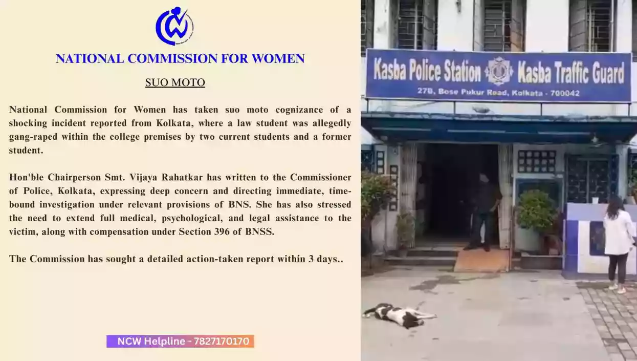
Protests erupt outside Kasba Police station as 3 arrested in alleged Kolkata college gang rape
.gif)
Download Mobile App 


.webp)
The Meteorological Office has issued a forecast predicting consistent rainfall until the middle of next week, citing consecutive weather systems forming in the Bay of Bengal. A depression, currently positioned approximately 770 km south of the Digha coastline and moving northwestwards, is anticipated to bring mild to moderate rainfall (10mm to 20 mm) to Kolkata on multiple occasions between Thursday and Saturday.
Following closely, a second Bay system, identified as a cyclonic circulation near the Tamil Nadu coast and moving northwards, is expected to prolong heightened chances of rain and cloud cover until around November 23. Despite concerns, the Alipore Met office has ruled out the likelihood of the two Bay of Bengal systems interacting or developing into a cyclone, stating that they are too far apart to collide.
Moving at a speed of 13 km per hour, the depression is forecasted to reach the Bangladesh coast by Saturday, emphasizing the potential for increased and prolonged rainfall. Regional Meteorological Centre (RMC) director G K Das dismissed the possibility of the Fujiwhara effect, where two tropical low-pressure areas interact and intensify, clarifying that the systems are too distant from each other. Notably, November, which typically witnesses a decline in minimum temperatures in Kolkata, has experienced slightly warmer conditions this year.
The anticipated rain spells are unlikely to lead to a significant reduction in temperature, as the frequent development of new systems in the Bay is expected to bring moisture and humidity to the Bengal coast, hindering the cooling effect of winds on the atmosphere. Thursday's weather is projected to have a maximum temperature of around 29°C and a minimum of 22°C.
.jpg)
.webp)
Muslim family leads 400-year-old Rath Yatra in Howrah symbolising Bengal’s communal harmony

Protests erupt outside Kasba Police station as 3 arrested in alleged Kolkata college gang rape

.webp)
.webp)
.webp)
.webp)
.webp)

 West Bengal
 Bihar
Bihar Uttar Pradesh
 Jharkhand